
3D Mapping & Surveying
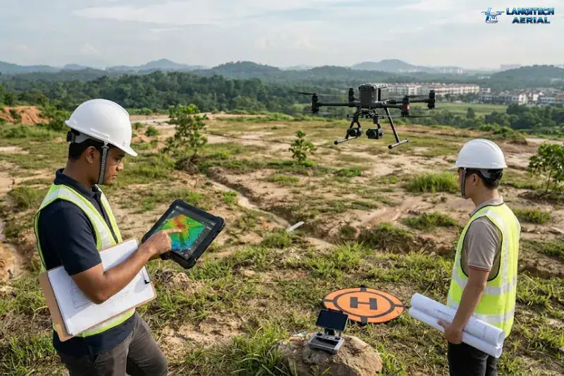
Every year, Malaysian developers find expensive problems on land they have just bought. Slope instability that nobody caught during the site walk. Drainage patterns that quietly make half the site undevelopable. Earthworks volumes that come in at triple the budgeted figure. Usually the cause is the same. Someone did the terrain survey from a desktop instead of ordering a proper drone land survey.
A drone survey will not fix every problem. However, it surfaces the big financial risks early, while you still have room to negotiate or redesign. Once the contracts are signed and the excavators arrive, the same mistakes cost millions to fix.
So this guide breaks down what a drone survey delivers at each stage of a Malaysian development project. It also covers what accuracy you actually need, and how to avoid paying for data you will never use.
Stage 1: Pre-Acquisition Assessment
Before your company commits to buying a parcel, you need to understand its physical characteristics. A few questions matter most. How much of the site is genuinely developable? What are the realistic cut-and-fill requirements? And does the topography force expensive retaining walls?
A pre-acquisition drone survey answers these quickly. It costs a fraction of conventional surveying and fits inside a tight due diligence window. For a 50-acre site, a professional operator can deliver a preliminary orthomosaic and Digital Elevation Model (DEM) in 3 to 5 working days.
That data feeds straight into your financial model. After all, the difference between a flat 50-acre site and one with severe grade changes can run to tens of millions of Ringgit in infrastructure cost.
Stage 2: Planning Submission Support
Malaysian local authorities, such as your Majlis Perbandaran or Majlis Daerah, require detailed topographic data for site plan submissions. Traditionally, developers rely entirely on a licensed land surveyor for this. Drone-derived topographic data now speeds the process up considerably.
The modern workflow runs like this. First, the drone produces the initial topographic data. Next, your civil consultant designs the road and drainage layouts from it. In parallel, a professional registered with the Land Surveyors Board Malaysia (LJT) certifies the legal boundaries. Finally, you combine both datasets and submit.
Stage 3: Earthworks Design and Volume Calculation
Once approvals are secured, your earthworks design needs real accuracy. This is where RTK-enabled drones earn their place.
Modern drone surveys use Ground Control Points (GCPs) to achieve vertical accuracy within 3 to 5 centimetres. That is enough for cut-and-fill modelling and quantity surveying.
Hillside sites in Selangor, Pahang, or Sabah add a further requirement. There you need a proper slope stability analysis. However, if the slopes carry thick jungle canopy, standard photogrammetry cannot see the ground at all. In that case, upgrade to a LiDAR survey to map the actual dirt beneath the trees.
Stage 4: During-Construction Monitoring
Once the machinery arrives, schedule weekly or fortnightly flights. These surveys track site progress against your approved earthworks plan.
As a result, you get a clear record of the volume moved in each period. That validates your payment certifications. The aerial map also catches over-excavation early, before it becomes costly to correct. For developers running several projects at once, this aerial view is a practical management tool.
What a Drone Land Survey Costs in Malaysia
Pricing varies considerably with your deliverables. Here are rough 2026 market rates for straightforward sites:
| Survey Type | Indicative Cost | What It Includes |
|---|---|---|
| Pre-acquisition assessment (up to 100 acres) | RM2,000 to RM4,500 | Orthomosaic and basic DEM, delivered in 1 to 2 days |
| Detailed topographic survey (up to 50 acres) | RM3,500 to RM8,000 | GCPs, contour maps, full reporting for planning submission |
| Construction monitoring | RM1,200 to RM2,500 per visit | Weekly volume calculation reports |
| LiDAR survey | From RM8,000 | Heavily forested sites |
Accuracy drives the price more than acreage does. So tell your operator exactly what decisions you need the data to support.
Need Help Planning a Compliant Drone Project in Malaysia?
Speak with our team about commercial drone operations, compliance requirements, and the right aerial solution for your project.