
3D Mapping & Surveying
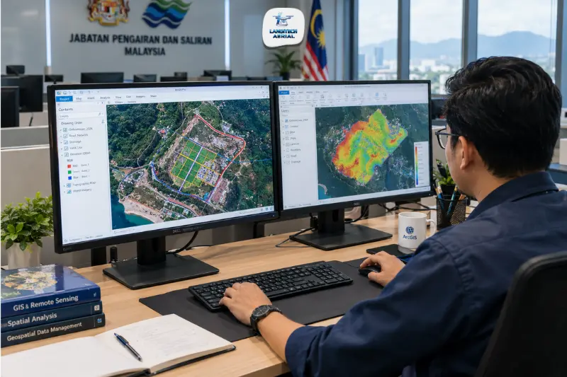
Drone GIS Malaysia is what connects aerial survey data collection to the geographic information systems that Malaysian government agencies, engineers, and planners actually use to make decisions. A drone survey produces raw data: orthomosaics, point clouds, DTMs, contour files. A GIS platform, ArcGIS or QGIS, turns that raw data into spatial analysis, visualisation, and decision-support outputs for Malaysian local authorities, JPS flood engineers, TNB asset managers, and urban planners. Getting drone data to integrate properly with Malaysian GIS workflows is what separates a useful survey from data that sits unprocessed in a folder somewhere. This guide covers the Malaysian GIS ecosystem, how drone outputs connect to each platform, and which applications get the most value out of it.
Key takeaways
- Drone GIS Malaysia integration delivers drone-captured spatial data directly into ArcGIS, QGIS, AutoCAD Civil 3D, and other platforms used by Malaysian government, utilities, and engineering firms.
- GDM2000 (Geodetic Datum Malaysia 2000) is the national coordinate system. Drone data intended for Malaysian GIS workflows has to be projected in GDM2000/RSO, not WGS84 alone.
- Key Malaysian GIS users for drone data include JPS (flood management), local authorities (OSC planning), TNB (asset management), DOA (agricultural monitoring), and oil palm estate management systems.
- Every drone data capture operation needs a CAAM ATF and a JUPEM APK aerial data permit before deployment. JUPEM’s own national geospatial platform is the authoritative base map for Malaysian GIS.
The Malaysian GIS ecosystem
ArcGIS: the government standard
ArcGIS, distributed exclusively in Malaysia by Esri Malaysia, is the dominant GIS platform across federal and state government agencies. JUPEM, the Department of Survey and Mapping Malaysia, runs the national geospatial infrastructure on ArcGIS-based platforms. JPS (Jabatan Pengairan dan Saliran) uses ArcGIS for flood modelling and catchment management. Local authorities, DBKL (Kuala Lumpur), MBPJ (Petaling Jaya), MPSP (Penang), and others manage their planning and infrastructure GIS on ArcGIS too.
For drone GIS Malaysia work delivered to government clients, ArcGIS-compatible outputs are the standard requirement. In practice that means GeoTIFF orthomosaics, ASC or GeoTIFF DTMs, and SHP or GDB feature classes that load directly into ArcGIS Pro, ArcGIS Online, or ArcGIS Enterprise with no conversion needed.
Esri’s Drone2Map converts drone imagery straight into ArcGIS-ready outputs: orthomosaics, 3D meshes, and point clouds formatted for ArcGIS Online and ArcGIS Pro. For Malaysian government and utility clients already working in the ArcGIS ecosystem, Drone2Map-processed drone data drops right into their existing spatial data infrastructure.
QGIS: the open-source alternative
QGIS gets heavy use from Malaysian engineering consultants, environmental consultancies, academic researchers, and NGOs who prefer open-source tools. It handles the standard drone GIS Malaysia outputs without issue: GeoTIFF orthomosaics, LAZ point clouds, DXF contour files, and SHP shapefiles.
QGIS is also the platform of choice for a lot of Malaysian plantation and agricultural management teams managing estate GIS data, mostly because it skips the licensing overhead of ArcGIS. Oil palm estate managers tracking block boundaries, road networks, and yield zones commonly run QGIS as their main spatial platform.
AutoCAD Civil 3D: the engineering design platform
Malaysian civil engineering consultants and contractors use AutoCAD Civil 3D as their design platform. It’s not a GIS platform in the traditional sense, but it’s a spatial design environment that consumes the same drone survey deliverables. DXF contour files, LandXML surfaces, and DWG point data from drone surveys feed straight into Civil 3D for road design, earthworks calculation, and drainage layout.
GDM2000: the coordinate system requirement you can’t skip
Every drone GIS Malaysia dataset needs to be projected in GDM2000 (Geodetic Datum Malaysia 2000) / RSO (Rectified Skewed Orthomorphic) to work with Malaysian national GIS infrastructure. This is the national coordinate reference system used by JUPEM, all federal and state government GIS, and Malaysian cadastral data.
By default, drone GPS systems record positions in WGS84, the global datum GPS satellites use. WGS84 and GDM2000 are close, but they’re not the same. For most engineering construction work, the difference doesn’t matter much. But when drone data has to overlay JUPEM cadastral layers, local authority base maps, or JPS hydrological data, all of which sit in GDM2000, an unprocessed WGS84 dataset will show a systematic offset.
When briefing a drone GIS Malaysia provider, specify GDM2000/RSO as the required coordinate reference system for every deliverable. If a provider can’t talk you through coordinate system transformation, they’re not set up for Malaysian government or utilities GIS work.
Malaysian GIS applications for drone data
JPS flood management GIS
JPS manages flood risk, drainage infrastructure, and catchment data through GIS platforms covering Malaysia’s major river basins. Drone survey data feeds into JPS GIS in two ways.
Terrain data for flood modelling. Drone-derived DTMs give JPS hydraulic engineers the bare-earth terrain models they feed into flood inundation models, defining catchment boundaries, flow paths, and flood extent at specific return periods. For a dedicated guide to flood mapping, read our drone flood mapping Malaysia guide.
Post-flood damage documentation. After a major flood event, drone orthomosaics documenting the flood extent and infrastructure damage feed into JPS GIS as date-stamped damage assessment layers, supporting mitigation planning and budget allocation.
Local authority planning GIS (OSC submissions)
Malaysian local authorities manage development control through OSC (One Stop Centre) planning submission systems, most of which run on ArcGIS-based spatial platforms. Planning submissions for development orders (DO) need topographic maps and site plans that local authorities load into their GIS for review.
Drone GIS Malaysia provides OSC-ready spatial data, georeferenced orthomosaics and topographic data in GDM2000/RSO that local authority GIS teams can load straight into their planning review platforms. For a guide to drone surveys in land development, read our drone land development Malaysia guide.
TNB and utility asset management GIS
TNB (Tenaga Nasional Berhad) manages electricity transmission and distribution assets across Peninsular Malaysia through GIS-based asset management systems. Utility asset managers use drone survey data to update their GIS records after infrastructure installation, modification, or damage events.
Drone GIS Malaysia for utility asset management delivers:
- Georeferenced pole, tower, and substation position data
- Transmission corridor orthomosaics for vegetation encroachment mapping
- As-built infrastructure positions for GIS asset record updates
TNB’s GIS platforms run on ArcGIS, so drone data delivered in ArcGIS-compatible GDM2000 format integrates directly, no extra conversion required.
Oil palm estate GIS management
Malaysian oil palm estates are increasingly running GIS platforms to manage block boundaries, road networks, yield zones, and crop health data. Drone survey data feeds several layers in estate GIS systems:
- Block boundary and road network layers. Updated from drone orthomosaic tracing, confirming actual block extents and road alignments against the estate GIS base.
- NDVI and crop health layers. From multispectral drone surveys, flagging low-vigour zones for targeted agronomic intervention.
- Infrastructure condition layers. Culvert positions, bridge locations, and drainage channel alignment from drone mapping.
For a detailed guide to oil palm estate mapping, read our drone oil palm mapping Malaysia guide.
Smart city GIS: DBKL, Iskandar, Putrajaya
Malaysia’s smart city initiatives, the Kuala Lumpur Smart City Master Plan (DBKL), Iskandar Malaysia’s digital infrastructure, and Putrajaya’s planned city management, all run on GIS as the spatial foundation. Drone GIS Malaysia supplies the high-resolution, current spatial data these systems need:
- Up-to-date building footprint and height data for 3D city models
- Road and utility infrastructure condition data
- Green space and vegetation coverage mapping
- Development progress tracking for urban growth monitoring
Standard drone GIS Malaysia output formats
| Output | Format | GIS platform |
|---|---|---|
| Orthomosaic | GeoTIFF (GDM2000/RSO) | ArcGIS, QGIS, Civil 3D |
| DTM / DSM | GeoTIFF, ASC | ArcGIS, QGIS |
| Contour lines | DXF, SHP | Civil 3D, ArcGIS, QGIS |
| Point cloud | LAZ/LAS | ArcGIS Pro, QGIS, Civil 3D |
| Feature classes | SHP, GDB | ArcGIS |
| 3D mesh | OBJ, SLPK (ArcGIS Scene Layer) | ArcGIS Online, ArcGIS Pro |
Always specify your target GIS platform and coordinate system when briefing your drone provider. Different platforms need different file formats, and GDM2000/RSO is mandatory for any Malaysian government GIS integration.
Frequently asked questions
What coordinate system should drone GIS Malaysia data use?
GDM2000 (Geodetic Datum Malaysia 2000) projected in RSO (Rectified Skewed Orthomorphic) is the national standard for Malaysian GIS data. Any drone data delivered for Malaysian government, local authority, utility, or cadastral GIS work needs to use GDM2000/RSO, not WGS84 alone, to overlay correctly with JUPEM base maps and other Malaysian national spatial datasets.
Does ArcGIS or QGIS work better for Malaysian drone GIS data?
Both handle drone GIS Malaysia outputs fine. It comes down to your organisation’s existing platform. ArcGIS is the Malaysian government standard, used by JUPEM, JPS, local authorities, and major utilities. QGIS gets more use from engineering consultants, environmental firms, and plantation managers who prefer open-source tools. For government client deliverables, always confirm which platform the client uses before processing, and set output formats accordingly.
Can drone orthomosaics replace satellite imagery in Malaysian GIS workflows?
For most local-area Malaysian GIS applications, planning, asset management, flood modelling, estate management, drone orthomosaics beat commercially available satellite imagery on resolution (2 to 5 cm versus 30 to 50 cm for commercial satellites), currency (captured on demand versus satellite revisit cycles), and spectral configuration (multispectral sensors available). They’re not a cost-effective replacement for national-scale mapping, where JUPEM topographic products and Landsat imagery still serve large-area needs better.
Conclusion
Drone GIS Malaysia bridges aerial data collection and the spatial platforms Malaysian decision-makers rely on every day. The value of a drone survey isn’t in the raw imagery. It’s in the GIS-ready outputs that load into ArcGIS, QGIS, and Civil 3D and become the spatial intelligence layer behind flood management, urban planning, utility asset management, and estate operations.
Getting the GIS integration right, GDM2000 coordinate systems, correct file formats for the target platform, and a data structure that matches the client’s existing GIS schema, is what separates drone data that actually gets used from data that gets filed away.
LangiTech Aerial delivers drone GIS Malaysia outputs configured for your specific GIS platform and coordinate system requirements, from ArcGIS-ready orthomosaics for government clients to QGIS-compatible estate mapping data for plantation managers.
Contact LangiTech Aerial to discuss your GIS integration requirements and get a drone survey quote.
For a full guide to drone mapping deliverables, read our drone photogrammetry Malaysia guide.
Need Help Planning a Compliant Drone Project in Malaysia?
Speak with our team about commercial drone operations, compliance requirements, and the right aerial solution for your project.