
3D Mapping & Surveying
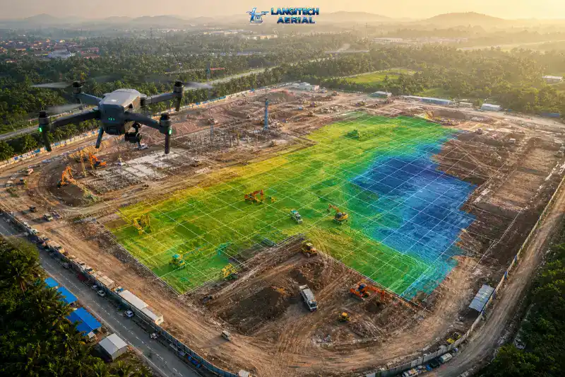
Drone mapping Malaysia has become one of the most practical tools available to construction teams, plantation managers, infrastructure engineers, and land developers. Instead of deploying large ground survey crews across difficult terrain, a single drone flight captures precise spatial data across hectares in hours. The output — orthomosaic maps, 3D point clouds, terrain models, and volumetric reports — integrates directly into CAD, GIS, and engineering workflows. This guide covers everything you need to know before engaging a drone mapping provider in Malaysia.
Key Takeaways
- Drone mapping Malaysia produces survey-grade outputs — orthomosaic maps, 3D point clouds, DSM/DTM models — in a fraction of the time traditional surveys require
- RTK-enabled drone mapping achieves centimetre-level accuracy without extensive ground control point (GCP) networks
- Commercial drone mapping in Malaysia requires both a CAAM Authorisation to Fly (ATF) and a JUPEM APK permit for aerial data acquisition
- Key industries using drone mapping in Malaysia include construction, land development, oil palm plantations, infrastructure, and environmental assessment
What Is Drone Mapping Malaysia and How Does It Work?
Drone mapping Malaysia uses unmanned aerial vehicles equipped with high-resolution cameras, multispectral sensors, or LiDAR payloads to capture overlapping aerial imagery across a defined area. Specialised photogrammetry software then processes those images into accurate, measurable spatial datasets and maps.
The result is not simply aerial photography. Unlike a regular drone photo, a drone-mapped orthomosaic carries geometric correction, georeferencing, and precise scaling — so every pixel represents a real-world coordinate. You can therefore measure distances, calculate areas, extract elevation data, and compare site conditions over time — all from a single flight dataset.
Step 1 — Flight Planning and CAAM / JUPEM Approval
Before any drone takes off, the operator plans the mission. This involves defining the survey area, setting flight altitude and overlap parameters, and obtaining the required permits from CAAM and JUPEM. Both approvals are mandatory for commercial drone mapping in Malaysia. Furthermore, you must secure them at least 14 working days before the flight date to avoid delays.
Step 2 — Aerial Data Capture
The drone executes a pre-programmed flight path autonomously, capturing hundreds or thousands of overlapping images across the survey area. RTK (Real-Time Kinematic) GPS technology locks each image to a precise coordinate during capture. Consequently, this reduces or eliminates the need for extensive ground control point (GCP) networks on the ground, saving both time and cost.
Step 3 — Data Processing
Back at the office, photogrammetry software — typically Pix4D, DJI Terra, or Agisoft Metashape — processes the imagery into the final deliverables. The software stitches images together, corrects geometric distortion, generates elevation models, and produces the point cloud and 3D outputs. Processing time therefore varies by site size and deliverable complexity.
Step 4 — Deliverables and Integration
The team then exports the completed datasets in formats compatible with AutoCAD, Civil 3D, ArcGIS, and other engineering or GIS platforms. The client receives clean, survey-ready files they can use immediately in their planning or reporting workflows.
What Drone Mapping Malaysia Delivers: Understanding Your Outputs
Many clients request drone mapping without fully understanding what they will receive. Here is a clear breakdown of the standard deliverables and what each one is used for.
Orthomosaic Map
An orthomosaic is a high-resolution aerial map stitched together from hundreds of individual drone images. The processing software geometrically corrects and georeferences each image, so every point on the final map corresponds to a real-world coordinate. The result is distortion-free and measurable.
Orthomosaic maps are therefore used for site boundary definition, construction progress reporting, plantation block mapping, and any application where a detailed, measurable top-down view of the site is needed. Moreover, project managers, clients, and non-technical stakeholders find orthomosaics easy to interpret — making them one of the most widely requested drone mapping Malaysia deliverables.
Digital Surface Model (DSM) and Digital Terrain Model (DTM)
A DSM captures the elevation of everything on the surface — including buildings, vegetation, and structures. A DTM, by contrast, represents the bare ground surface only, with above-ground features stripped out. Both outputs are essential for earthworks planning, cut-and-fill calculations, drainage design, and terrain analysis.
In Malaysian construction projects specifically, DTMs support pre-construction topographic surveys and earthworks volume reporting. For plantation and forestry applications, DSMs additionally help assess canopy height and identify terrain irregularities across large areas.
3D Point Cloud
A point cloud is a dense collection of georeferenced data points that represent the surface of the survey area in three dimensions. The processing pipeline derives all other 3D outputs — models, meshes, and measurements — from this raw dataset.
Engineers and surveyors work directly with point cloud data in CAD and GIS software to extract precise measurements and generate reports. Specifically, point clouds support structural analysis, infrastructure inspection documentation, BIM integration, and detailed volume calculations.
Volumetric Reports
Drone mapping Malaysia software calculates accurate volume measurements directly from the point cloud or DSM data. This is particularly valuable for construction earthworks, stockpile management in quarrying and mining operations, and cut-and-fill reporting during land development.
Volumetric reporting from drone data replaces the manual stockpile measurement process — which is slow, physically hazardous, and often inaccurate on large sites. As a result, project teams save significant time and improve reporting accuracy.
Contour Lines and Topographic Maps
The DTM generates contour data that shows elevation change across the site in standard 2D topographic map format. This output integrates directly into AutoCAD and Civil 3D for engineering design and planning work. In addition, contour data supports drainage modelling and earthworks design at the early planning stage.
For more detail on drone survey deliverables, read our drone land survey Malaysia guide.
Industries Using Drone Mapping Malaysia Services
Construction and Land Development
Drone mapping Malaysia sees its heaviest use across Malaysia’s active construction sector. Developers use pre-construction topographic surveys to plan earthworks and drainage. Project managers, meanwhile, use progress monitoring flights to document site conditions against the original design. Post-construction, as-built surveys verify that completed works match approved plans.
Furthermore, drone mapping significantly speeds up the topographic survey stage for new development projects. A 40-hectare site that takes days with a ground team can be mapped in a single morning flight. As a result, project timelines move faster and decision-making improves considerably.
For a construction-specific breakdown, read our drone mapping for construction Malaysia guide.
Oil Palm and Rubber Plantations
Malaysia manages over 5.8 million hectares of oil palm. Drone mapping gives estate managers accurate plantation inventory data — tree counts, block boundaries, canopy health maps, road and drain mapping — across large areas in a fraction of the time traditional ground surveys require.
In addition, multispectral drone mapping produces NDVI and SAVI index maps that identify crop stress zones, disease hotspots, and areas of underperformance. This data consequently supports fertiliser application planning and pest management decisions directly.
For plantation drone applications, read our smart farming Malaysia drone guide.
Infrastructure and Utilities
Power line corridor surveys, road and highway inspections, pipeline route planning, and flood-risk mapping all rely on drone mapping Malaysia across the infrastructure sector. Drone systems survey long linear corridors quickly and safely — without placing inspection teams in hazardous terrain or requiring lane closures on active roads.
Notably, drone LiDAR mapping penetrates vegetation canopy to capture ground-level terrain data in forested corridors. This is therefore a critical advantage for infrastructure projects in Malaysia’s heavily vegetated landscapes.
For LiDAR-specific applications, read our LiDAR vs photogrammetry drone survey Malaysia guide.
Forestry, Environment, and Flood Risk
Government agencies, environmental consultants, and RSPO-certified plantation groups use drone mapping Malaysia for forest boundary surveys, biodiversity assessment, and flood-risk documentation. After major flooding events, rapid drone mapping of affected areas provides actionable data for relief coordination and damage assessment — far faster than any ground-based alternative. Consequently, many state agencies now include drone mapping in their emergency response protocols.
Drone Mapping Malaysia vs Traditional Ground Survey
Traditional ground surveys using total stations, GPS rovers, and manual measurement teams remain the benchmark for cadastral and highly precise engineering surveys. However, drone mapping Malaysia outperforms traditional methods on speed, coverage, and cost for most project types.
| Factor | Traditional Ground Survey | Drone Mapping Malaysia |
|---|---|---|
| Speed | Days to weeks for large sites | Hours to 1–2 days |
| Coverage rate | Low (point-by-point) | High (entire area per flight) |
| Data density | Thousands of points | Millions of points |
| Worker safety risk | High on difficult terrain | Low (minimal ground team) |
| Cost | Higher for large areas | Lower for large areas |
| Accuracy | Survey-grade (cadastral) | Survey-grade (RTK) to ±2–5 cm |
| Legally binding cadastral work | Yes | No — requires licensed surveyor sign-off |
The key distinction here is legally binding cadastral surveys. In Malaysia, registered land surveys submitted to JUPEM for title or boundary purposes must have a Licensed Land Surveyor (LLS) conduct and certify them. Drone mapping Malaysia, however, supports and accelerates that process. Moreover, many licensed surveyors now integrate drone data collection into their workflows, using drone-captured datasets to generate the plans and reports they then certify.
For all other purposes — construction planning, progress monitoring, plantation inventory, infrastructure inspection, and volumetric reporting — drone mapping Malaysia delivers faster, more data-rich results at lower cost.
CAAM and JUPEM Compliance for Drone Mapping Malaysia
This is where many clients are caught off guard. Drone mapping Malaysia requires not one but two separate regulatory approvals.
CAAM Authorisation to Fly (ATF)
All commercial drone operations in Malaysia require an ATF from CAAM under the Civil Aviation Regulations 2016 (Part XVI). The operator applies through the ASOS portal with a minimum 14 working days’ lead time. The ATF then authorises the specific flight area, dates, and operational conditions.
Your provider’s pilot must also hold the Remote Pilot Certificate of Competency — Basic (RCoC-B). This is CAAM’s commercial drone pilot certification. Without it, the operation is not compliant — regardless of how experienced the pilot claims to be.
JUPEM APK Permit for Aerial Data Acquisition
This is the permit most clients don’t know about. For any commercial drone operation involving aerial data acquisition — mapping, photography, or filming — the Department of Survey and Mapping Malaysia (JUPEM) requires a separate permit known as the APK (Aerial Photography and Keying) approval.
The APK permit involves a security clearance process through which JUPEM authorises and controls aerial data capture over Malaysian territory. For standard commercial mapping projects, the application is straightforward. However, it adds to the preparation lead time and must therefore be factored into your project schedule early.
A professional drone mapping Malaysia provider handles both the CAAM ATF and JUPEM APK applications as part of their service. Always ask a prospective provider to confirm they manage both approvals — and request copies of the permits before work begins.
For a complete breakdown of Malaysian drone regulations, read our CAAM drone regulations Malaysia guide.
What to Ask Your Drone Mapping Provider
Before engaging any provider, ask these five questions:
- Do you handle both CAAM ATF and JUPEM APK permit applications for the project?
- Are your pilots RCoC-B certified? Can you provide documentation?
- What drone and sensor configuration will you use for my site type?
- What deliverable formats do you provide, and do they integrate with AutoCAD or ArcGIS?
- What is your data processing turnaround time after the flight?
A capable drone mapping Malaysia provider answers all five without hesitation.
Drone Mapping Malaysia Cost: What Drives Pricing
No reputable drone mapping provider in Malaysia publishes a fixed rate card. Pricing varies by project, and for good reason — the factors below all affect what a job actually costs.
Site size: Larger sites require more flight time, more battery cycles, and longer data processing. Most providers therefore price by hectare for area-based jobs, with lower per-hectare rates for larger areas.
Required accuracy: Standard photogrammetry with RTK GPS achieves ±2–5 cm accuracy. However, projects requiring higher precision — such as engineering surveys with GCP networks — involve additional field time and cost.
Sensor type: Photogrammetry using an RGB camera is the most cost-effective option. LiDAR surveys, by contrast, cost more due to sensor hire and specialist processing — though they penetrate vegetation canopy in ways RGB cameras cannot.
Deliverables: An orthomosaic and basic DTM costs less to produce than a full package including point cloud, volumetric report, contour data, and CAD-ready files. Consequently, specifying exactly what outputs you need before requesting a quote leads to more accurate pricing.
Permit complexity: Sites near airports, in controlled airspace, or in sensitive areas require additional CAAM coordination. This adds lead time and, in some cases, additional cost.
Location and mobilisation: Sites in East Malaysia (Sabah and Sarawak) or remote locations involve mobilisation costs that Peninsula-based jobs do not. Similarly, sites requiring multiple return visits for progress monitoring attract different pricing than single-visit surveys.
For a detailed cost breakdown by project type, read our drone mapping cost Malaysia guide.
Frequently Asked Questions
What is the difference between drone mapping and drone photography?
Drone photography captures images for visual or creative purposes. Drone mapping Malaysia, by contrast, captures data for measurement and analysis. Mapping flights follow precise, pre-programmed paths with defined overlap parameters. The output is therefore georeferenced, measurable, and spatially accurate — not simply a photograph. Drone mapping also requires CAAM and JUPEM permits that standard aerial photography may not.
How accurate is drone mapping in Malaysia?
With RTK-enabled drones and a well-planned flight, drone mapping Malaysia achieves horizontal accuracy of ±2 to 5 centimetres and vertical accuracy of ±3 to 7 centimetres under good conditions. For engineering applications requiring tighter tolerances, a GCP network placed and surveyed by a licensed surveyor further improves absolute accuracy. Always ask your provider to specify the accuracy methodology before committing to a project.
How long does a drone mapping project take in Malaysia?
A straightforward site of 10 to 50 hectares typically involves one day of fieldwork and two to five working days for data processing and deliverable preparation. Larger sites and projects requiring LiDAR or multispectral data take longer. Moreover, CAAM and JUPEM approvals add 14 to 21 days to the pre-flight preparation phase. Factor this into your project schedule when engaging a provider.
Can drone mapping replace a licensed land survey in Malaysia?
No — not for cadastral purposes. Under Malaysian law, a registered Licensed Land Surveyor (LLS) must conduct and certify land surveys submitted to JUPEM for title or boundary purposes. However, drone mapping Malaysia data integrates with and significantly accelerates the licensed surveyor’s workflow. As a result, most major survey firms now incorporate drone data collection as part of their service delivery.
Do I need to be present on site during the drone mapping flight?
Not necessarily. Most drone mapping Malaysia operators require site access coordination and a point of contact for safety clearances. You do not need to supervise the flight yourself. However, being present for the pre-flight briefing is useful — especially if the site has specific access restrictions, sensitive structures, or equipment in use during the survey.
Conclusion
Drone mapping Malaysia has moved well beyond a novelty technology. For developers, project managers, estate operators, and infrastructure teams, it is now the practical standard for fast, accurate, and cost-effective spatial data collection.
The key to a successful project is therefore choosing a provider who manages the full process — CAAM and JUPEM approvals, RTK-accurate data capture, professional processing, and deliverables that integrate cleanly into your engineering and reporting workflows.
LangiTech Aerial provides CAAM-compliant drone mapping services across Peninsula Malaysia. We manage all permit applications, deploy RTK-enabled survey platforms, and deliver survey-grade outputs in formats ready for your engineering team.
Contact LangiTech Aerial to discuss your mapping requirements and get a project quote.
Need Help Planning a Compliant Drone Project in Malaysia?
Speak with our team about commercial drone operations, compliance requirements, and the right aerial solution for your project.