
3D Mapping & Surveying
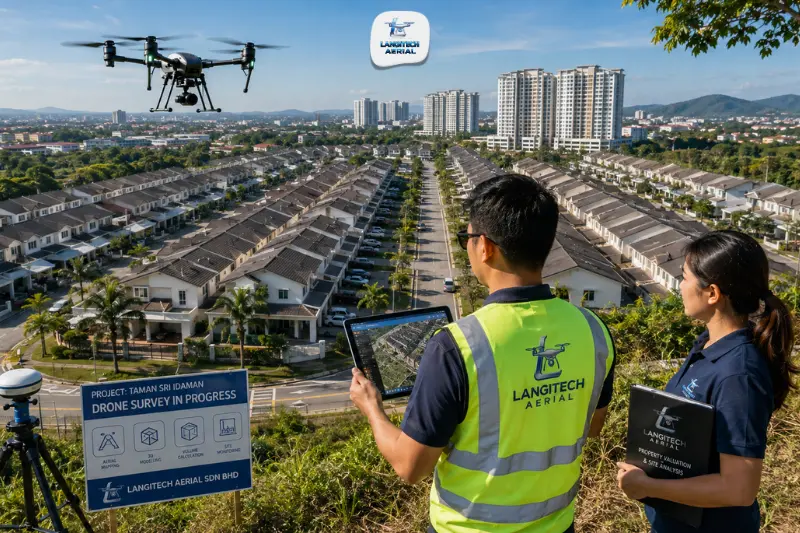
A drone property survey gives buyers, valuers, estate agents, banks, and insurers a look at a property that ground-level inspection simply can’t provide: roof condition, land boundary extent, drainage, slope exposure, and site context, all captured in a single flight. Maybe you’re a buyer doing pre-purchase checks on a hillside bungalow. Maybe you’re a JPPH-registered valuer supporting a mortgage application, or an insurance assessor documenting storm damage on a commercial building. In each case, drone data now plays a real role in how these decisions get made in Malaysia. This guide covers who uses drone property surveys, what each application actually delivers, and what to check for in a compliant provider.
Key takeaways
- Drone property survey Malaysia covers five main applications: pre-purchase assessment, mortgage valuation support, strata property documentation, insurance claims documentation, and estate boundary verification.
- Property valuers registered with JPPH (Jabatan Penilaian dan Perkhidmatan Harta) are turning to drone aerial data to support valuation reports on large or complex properties, particularly landed properties, commercial assets, and industrial facilities.
- Drone surveys can’t replace a Licensed Land Surveyor for legal boundary demarcation, but they do provide spatial context that supports valuation, planning, and due diligence decisions.
- Every drone property survey in Malaysia needs a CAAM ATF and a JUPEM APK aerial data permit before takeoff.
What is drone property survey Malaysia?
Drone property survey Malaysia is the use of aerial drone imagery and spatial data capture to document a property’s physical condition, extent, and surroundings from above. Ground-level inspection only shows an inspector what’s accessible from where they’re standing. A drone gets the rest of the picture, including:
- Roof surface condition across the entire roof area
- Land boundary extent and how the property relates to its neighbours
- Drainage patterns, retaining walls, slopes, and site topography
- Access roads, car parks, and external infrastructure
- Surrounding land use: roads, utilities, and what’s next door
The output is a set of georeferenced orthomosaic imagery and elevation data. Anyone involved in a property transaction or assessment gets an objective, spatial view of what the property actually is, not just what someone chose to photograph.
Five applications of drone property survey Malaysia
1. Pre-purchase due diligence
Buying property in Malaysia, especially a landed property, bungalow lot, or commercial asset, means committing significant capital with limited visibility into its physical condition. Estate agents pick their best photos. Developers’ marketing images are aspirational at best. Neither shows you roof condition, drainage slope, or how the neighbouring sites actually look, and all three affect a property’s long-term value and risk.
A drone survey gives a pre-purchase buyer:
- High-resolution imagery of the full roof surface, so cracking, vegetation growth, broken tiles, rusted metal sheets, and blocked gutters show up even though ground inspection would miss them
- A read on site drainage: natural drainage direction, retention points, and any visible drainage infrastructure
- For hillside or elevated properties, an overview of slope angle, retaining wall condition, and any visible signs of soil movement or erosion
- Boundary and neighbouring site context: how much land is actually there compared to the title plan, and what condition the neighbouring plots are in
For commercial and industrial purchases, factories, warehouses, retail complexes, drone surveys also capture the rooftop equipment inventory (air-conditioning, mechanical, electrical plant) along with access road and loading bay conditions that affect whether the site actually works for your operations.
2. Mortgage valuation support
Malaysian banks require a valuation report from a JPPH-registered valuer before approving mortgage financing. For complex properties, large bungalow lots, commercial properties, industrial facilities, or developments with significant land area, more valuers are using drone aerial data alongside their site inspection.
A drone survey gives mortgage valuers:
- Georeferenced aerial imagery of the property and its immediate surroundings
- A site area estimate to check against the title particulars
- Building footprint and roof coverage extent, useful for built-up area estimation
- Documentation that backs up the valuer’s inspection notes
Drone imagery also creates an objective, date-stamped record of site conditions at the time of valuation, which matters both for the report itself and for any dispute later about what condition the property was in when it was financed.
3. Strata property documentation
Condominiums, serviced apartments, and commercial strata properties in Malaysia need accurate documentation of common property for JMB and MC management under the Strata Management Act 2013. When owners and JMBs disagree about the condition or extent of common property, that dispute increasingly gets settled with reference to actual spatial evidence, not opinion.
Drone surveys support strata management with:
- Periodic roof and facade condition documentation for maintenance planning
- Records of car park, driveway, and external infrastructure condition
- Boundary fence and wall condition documentation, useful when maintenance responsibility is disputed
- Landscape and drainage area records that feed into annual maintenance budgets
4. Insurance claims documentation
After a storm, flash flood, or fire, property insurers need documentation of the damage before a claim can move forward. Ground-level photos are selective by nature and rarely capture the full extent of roof and upper-structure damage.
A drone survey gives insurance assessors and claimants:
- Full roof damage documentation from above, including the extent of storm damage, missing tiles, and structural compromise
- Flooding extent and drainage overflow, seen from a vantage point ground photos can’t reach
- Context on surrounding site damage: neighbour damage, drainage overflow paths, debris distribution
- Date-stamped, georeferenced imagery that stands as admissible evidence of conditions at a specific point in time
Insurers themselves also commission drone surveys to verify claims, checking that reported damage actually matches what the imagery shows before releasing a settlement.
5. Estate boundary and land context verification
Before buying land or settling a dispute over it, buyers and their lawyers need an objective picture of what the land actually is: its real extent, what borders it, and whether anything is encroaching on it.
A high-resolution aerial survey can help identify:
- Visible boundary markers and how they relate to neighbouring structures
- Possible encroachments, where a structure from a neighbouring plot appears to extend onto the subject land
- Actual vegetation coverage, water bodies, and terrain features that affect how usable the land is
- Access road condition and available frontage
This kind of aerial evidence supports pre-purchase legal due diligence and gives land lawyers and conveyancing solicitors spatial context when they’re reviewing title documents.
What drone property survey Malaysia cannot do
A provider worth hiring will be upfront about the limits.
Legal boundary demarcation. Under the Licensed Surveyors Act 1958, boundary demarcation for land title purposes has to be done by, or under the supervision of, a Licensed Land Surveyor. A drone survey gives you spatial context, not a legally binding boundary position.
Structural condition assessment. Drone imagery shows visible surface conditions: cracking, corrosion, tile damage, water staining. It can’t tell you about structural integrity, bearing capacity, or defects hidden from view. Pair drone survey data with a qualified structural engineer’s inspection for anything complex.
Underground features. Drainage pipes, utility routes, and anything below the surface won’t show up in aerial imagery. Drone surveys only document what’s visible from above.
CAAM and JUPEM compliance for drone property survey Malaysia
Every drone property survey in Malaysia requires:
CAAM ATF. An Authorisation to Fly from CAAM, applied for at least 14 working days before the survey. Surveys over occupied residential properties also have to meet CAAM’s requirements for flights near people and structures.
JUPEM APK permit. Drone property surveys capture georeferenced aerial data, which triggers JUPEM’s aerial data acquisition security clearance requirement. Apply through the eBiz JUPEM portal before you apply for the CAAM ATF.
For the full breakdown, read our drone permit Malaysia requirements guide.
Frequently asked questions
Can a drone survey replace a physical property inspection in Malaysia?
No, and a provider that tells you otherwise isn’t being straight with you. A drone survey captures external, aerial spatial data that complements a ground-level inspection. It shows full roof condition, site extent, drainage patterns, and surrounding context that a ground inspection can’t reach. But internal condition, structural integrity, and mechanical or electrical systems still need a qualified physical inspection. Use drone data alongside a ground inspection, not in place of one.
Do Malaysian banks accept drone survey reports for mortgage valuation?
A drone survey report doesn’t replace the JPPH-registered valuer’s report that banks require for mortgage applications. But JPPH valuers may commission a drone survey as part of their own site inspection for complex properties, and the imagery can end up as supporting documentation inside a formal valuation report. Ask your appointed valuer whether a drone survey of your property would help their assessment.
How much does a drone property survey in Malaysia cost?
It depends on property size, location, and what deliverables you need. As a rough guide for 2026: residential landed property (standard lot) runs RM 600 to RM 1,500; commercial property (SME scale) runs RM 1,200 to RM 3,500; and a large industrial facility runs RM 2,500 to RM 6,000. Contact LangiTech Aerial for a quotation based on your actual property.
Conclusion
Drone property survey Malaysia gives buyers, valuers, insurers, and legal professionals an objective, georeferenced aerial view of a property that ground-level inspection alone can’t deliver. From pre-purchase roof condition checks and mortgage valuation support to storm damage claims and strata common property records, drone surveys add a layer of spatial evidence to property decisions in Malaysia that matters more each year.
The limitations are real. Drone surveys support professional inspection and valuation, they don’t replace them. Within that boundary, though, they deliver real value at a fraction of the time and cost of scaffold-based or traditional aerial documentation.
LangiTech Aerial provides CAAM and JUPEM-compliant drone property survey services for residential, commercial, and industrial properties across Peninsula Malaysia.
Contact LangiTech Aerial to discuss your property survey requirements and get a quote.
For construction and development survey applications, read our drone land survey Malaysia guide.
Need Help Planning a Compliant Drone Project in Malaysia?
Speak with our team about commercial drone operations, compliance requirements, and the right aerial solution for your project.