
3D Mapping & Surveying
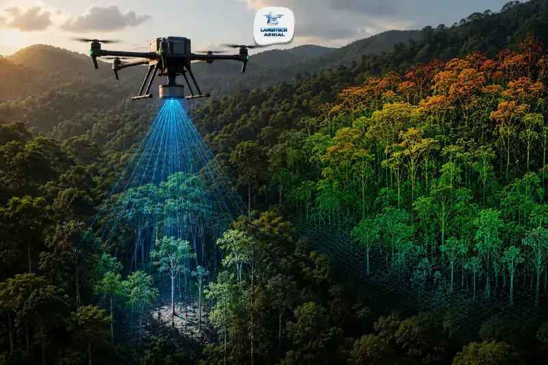
A LiDAR drone survey Malaysia operation gives engineers and project managers something photogrammetry cannot — accurate ground terrain data beneath dense vegetation. In a country where construction projects regularly begin on forested land, infrastructure corridors cut through tropical jungle, and plantation estates stretch across thousands of hectares, this capability matters enormously. This guide explains how LiDAR drone surveys work, when your project needs one, what deliverables you receive, and what it costs.
Key Takeaways
- A LiDAR drone survey Malaysia uses laser pulses to capture ground terrain data even through dense tropical forest canopy — something photogrammetry cannot do
- LiDAR achieves ±1 to 5 cm vertical accuracy and generates point clouds of 100 to 300 points per square metre
- The primary decision factor is vegetation: for open or cleared sites, photogrammetry is more cost-effective; for vegetated terrain, LiDAR is the only reliable option
- All commercial LiDAR drone survey Malaysia operations require both a CAAM ATF and a JUPEM APK permit before any flight
What Is a LiDAR Drone Survey Malaysia?
A LiDAR drone survey Malaysia uses an unmanned aerial vehicle fitted with a LiDAR (Light Detection and Ranging) sensor to scan a site with millions of laser pulses per second. The sensor measures the time each pulse takes to return after hitting a surface. It then builds a dense, three-dimensional point cloud that captures the precise geometry of everything below the flight path — including the ground beneath vegetation.
This is the fundamental advantage LiDAR holds over photogrammetry. A camera captures what it can see. LiDAR laser pulses, however, penetrate gaps in forest canopy and record multiple return signals — the top of the canopy, the understory, and the bare ground beneath. As a result, a LiDAR drone survey Malaysia delivers accurate bare-earth terrain models even in Malaysia’s dense tropical forests, where photogrammetry would only see the treetops.
How LiDAR Drone Survey Malaysia Works
The LiDAR Sensor and Data Capture
The drone carries a LiDAR sensor — typically a DJI Zenmuse L2, Riegl miniVUX, or equivalent — along with an integrated IMU (Inertial Measurement Unit) and RTK GPS system. As the drone flies a pre-programmed path, the LiDAR sensor fires hundreds of thousands of laser pulses per second in all directions. The system records the position, timing, and intensity of every returning pulse.
The result is a raw point cloud — a dataset of millions of georeferenced 3D points covering the entire survey area. This point cloud forms the foundation for all downstream deliverables.
Point Cloud Classification
Back at the office, the processing team classifies the raw point cloud into layers — ground points, low vegetation, medium vegetation, high vegetation, buildings, and other features. This classification step is what allows the software to separate the bare ground surface from the canopy above it. Consequently, the team generates a bare-earth Digital Terrain Model (DTM) even in fully forested areas.
This step distinguishes a professional LiDAR drone survey Malaysia from basic drone data collection. Classification quality directly affects deliverable accuracy — always ask your provider about their processing workflow and classification methodology.
Deliverable Generation
From the classified point cloud, the team generates all requested outputs in standard engineering and GIS formats. Processing typically completes within three to seven working days after the flight, depending on area size and deliverable complexity.
What a LiDAR Drone Survey Malaysia Delivers
Dense 3D Point Cloud (LAS/LAZ)
The point cloud is the primary output of every LiDAR drone survey Malaysia. It contains millions of georeferenced 3D points classified by surface type. Engineers use it directly in CAD and GIS platforms for structural analysis, volume calculations, BIM integration, and detailed site modelling.
For Malaysian projects, typical point density ranges from 100 to 300 points per square metre at standard survey altitudes — significantly denser than photogrammetry point clouds on vegetated terrain.
Bare-Earth Digital Terrain Model (DTM)
The DTM represents the ground surface only, with all vegetation and structures removed. It is the most critical output for infrastructure design, earthworks planning, drainage modelling, and slope stability analysis on vegetated Malaysian terrain.
Without LiDAR, generating a reliable DTM on forested land requires clearing the vegetation first — which adds cost, time, and environmental impact. A LiDAR drone survey Malaysia eliminates this entirely.
Digital Surface Model (DSM)
The DSM captures the top of everything on site — canopy tops, rooftops, structures, and terrain. Combined with the DTM, it allows analysts to calculate canopy height models and vegetation structure data. This is particularly valuable for plantation canopy assessments and forestry management applications.
Contour Lines and Topographic Maps
The DTM generates standard contour line data in DXF or DWG format for use in AutoCAD and Civil 3D. This output supports early-stage earthworks design, road alignment planning, and drainage modelling — and it is one of the most commonly requested deliverables on infrastructure pre-feasibility studies.
Intensity and RGB Imagery
Many LiDAR systems capture co-registered imagery alongside the point cloud data. This adds visual context to the 3D data and enables colourised point cloud outputs. As a result, the deliverable is both spatially accurate and visually interpretable for non-technical stakeholders.
For a comparison of all drone survey deliverables, read our drone mapping Malaysia complete guide.
When to Choose a LiDAR Drone Survey Malaysia
This is the decision most clients get wrong. LiDAR is not always necessary — and it costs significantly more than photogrammetry. Here is a clear framework.
Choose LiDAR when:
Your site has dense or tall vegetation. If trees cover the ground and you need accurate terrain data beneath the canopy, LiDAR is the only viable method. Photogrammetry cannot penetrate canopy — it maps the top of the trees, not the ground below.
You are planning infrastructure through forested corridors. Road alignments, pipeline routes, power line corridors, and railway feasibility studies in Malaysia’s forested interior all require bare-earth terrain data. LiDAR delivers this without clearing the route first.
Slope stability and geohazard assessment is required. In hilly terrain — Sabah, Sarawak, Cameron Highlands, Titiwangsa Range — engineers need precise ground elevation to model slope angles, drainage patterns, and potential failure zones. LiDAR provides this accurately even through dense undergrowth.
Flood risk modelling requires micro-topography. LiDAR captures subtle elevation changes of 10 to 30 centimetres that photogrammetry misses under vegetation. Hydrological engineers use this for flood catchment delineation and drainage design in low-lying areas across Kelantan, Johor, and Perak.
Powerline corridor inspection and vegetation encroachment monitoring. LiDAR captures wire geometry and vegetation structure simultaneously in a single flight. This is essential for electricity utilities managing clearance compliance across Malaysia’s transmission network.
Choose photogrammetry instead when:
Your site is open, cleared, or has only low ground cover — construction earthworks, cleared plantation blocks, or open land development sites. In these conditions, photogrammetry delivers equivalent accuracy at significantly lower cost. LiDAR’s canopy penetration advantage simply does not apply to open terrain.
For a full comparison, read our LiDAR vs photogrammetry drone survey Malaysia guide.
LiDAR Drone Survey Malaysia Applications by Industry
Construction and Land Development
Before breaking ground on forested land, developers need accurate ground terrain data for earthworks design and BOQ preparation. A LiDAR drone survey Malaysia delivers a complete bare-earth DTM of the forested site in one to two days. Traditional methods require clearing vegetation first — adding weeks and significant cost to the pre-design phase. Furthermore, as Terra Drone Malaysia notes, when you need terrain data of a forested construction site, LiDAR is the only viable option.
Infrastructure Corridors
Malaysia’s major infrastructure projects — expressways, the East Coast Rail Link, Pan Borneo Highway — regularly traverse forested and hilly terrain. LiDAR drone surveys support feasibility studies, alignment design, earthworks volume estimation, and slope stability assessment across these corridors. A real-world example: a Malaysian team completed 150 square kilometres of road corridor mapping with 5.51 cm vertical accuracy using a drone LiDAR system — a task that would have taken months with traditional methods.
Oil Palm and Plantation Management
Large plantation estates use LiDAR drone survey Malaysia data for drainage planning, road network design, terrain modelling across undulating blocks, and flood-prone area identification. LiDAR is especially valuable in mature estates where canopy height makes photogrammetry unreliable for ground-level terrain mapping. For a broader guide to plantation drone services, read our smart farming Malaysia drone guide.
Slope Stability and Geohazard Assessment
In Malaysia’s highland and hilly regions, LiDAR drone surveys help geotechnical engineers assess slope angles, map potential failure zones, and design retaining and reinforcement systems before excavation begins. This reduces project risk significantly on sensitive terrain.
Environmental and Flood Risk Mapping
Government agencies and environmental consultants use LiDAR drone survey Malaysia data for flood catchment delineation, wetland boundary mapping, and post-disaster terrain assessment. After major flooding events in Kelantan, Johor, or Selangor, rapid LiDAR surveys of affected areas produce terrain data that supports infrastructure repair and flood mitigation planning.
CAAM and JUPEM Requirements for LiDAR Drone Survey Malaysia
Every commercial LiDAR drone survey Malaysia operation requires two regulatory approvals — and many clients only know about one of them.
CAAM ATF: CAAM requires an Authorisation to Fly for all commercial drone operations under the Civil Aviation Regulations 2016 (Part XVI). The operator applies through the ASOS portal at least 14 working days before the flight. Pilots must hold the RCoC-B certification.
JUPEM APK Permit: The Department of Survey and Mapping Malaysia (JUPEM) requires a separate APK aerial data acquisition permit for any commercial drone operation that captures spatial data — including LiDAR flights. This security clearance process is mandatory and separate from the CAAM ATF. Always confirm that your provider manages both applications, not just the flight permit.
A professional provider handles both permit applications as standard. Request copies of both before any flight begins.
For a complete breakdown of drone regulations, read our CAAM drone regulations Malaysia guide.
LiDAR Drone Survey Malaysia Cost: What to Expect
LiDAR drone surveys cost significantly more than equivalent photogrammetry surveys. The primary reasons are sensor hire — a professional LiDAR payload costs substantially more than a standard mapping camera — and the more intensive data processing that classified point cloud production requires.
As a general guide for 2026 Malaysian market conditions:
| Project Size | LiDAR Drone Survey (est. RM) | Photogrammetry Equivalent (est. RM) |
|---|---|---|
| Small site (<50 ha) | RM 12,000 – RM 20,000 | RM 3,500 – RM 8,000 |
| Medium site (50–200 ha) | RM 20,000 – RM 40,000 | RM 7,000 – RM 18,000 |
| Large site (200–500 ha) | RM 35,000 – RM 70,000 | RM 15,000 – RM 30,000 |
The cost premium is justifiable when LiDAR’s canopy penetration capability is genuinely needed. For open sites where photogrammetry delivers the same result, however, the premium adds no value. Always ask your provider to assess whether your site conditions actually require LiDAR before accepting a LiDAR quote.
For a full breakdown of drone survey pricing, read our drone mapping cost Malaysia guide.
What to Ask a LiDAR Drone Survey Malaysia Provider
Before engaging a provider, ask these six questions:
- Do you handle both the CAAM ATF and JUPEM APK permit applications for LiDAR flights?
- What LiDAR sensor do you use, and what is its rated accuracy and point density?
- How do you classify the point cloud — what software and methodology?
- What deliverable formats do you provide — LAS/LAZ, DEM, DTM, DXF contours?
- What is your processing turnaround after the flight?
- Can you provide an accuracy report with checkpoint validation?
A professional LiDAR drone survey Malaysia provider answers all six clearly. If a provider cannot explain their classification methodology or accuracy validation process, treat that as a red flag.
Frequently Asked Questions
Can LiDAR penetrate dense forest canopy in Malaysia?
Yes — this is LiDAR’s defining advantage over photogrammetry. LiDAR laser pulses travel through gaps in forest canopy and record multiple return signals from different layers — canopy top, understory, and bare ground. A LiDAR drone survey Malaysia in a mature oil palm estate or secondary forest therefore produces an accurate bare-earth DTM that photogrammetry cannot. The denser the canopy, the greater the advantage.
How accurate is a LiDAR drone survey Malaysia?
A professional LiDAR drone survey Malaysia achieves vertical accuracy of ±1 to 5 cm under normal operating conditions, with point densities of 100 to 300 points per square metre at standard survey altitudes. Real-world Malaysian project data confirms vertical accuracy as low as ±5.51 cm across 150 square kilometres of forested road corridor. Always ask your provider for a checkpoint validation report to confirm accuracy on your specific project.
When should I choose LiDAR over photogrammetry in Malaysia?
Choose LiDAR when your site has dense or tall vegetation and you need accurate ground terrain data beneath the canopy. For open, cleared, or low-cover terrain — construction earthworks, cleared plantation blocks, open land sites — photogrammetry delivers equivalent accuracy at significantly lower cost. In other words, the decision comes down to one question: do you need to see through vegetation to the ground below?
How long does a LiDAR drone survey Malaysia project take?
Field capture for a 50 to 200 hectare site typically takes one to two days. Point cloud processing, classification, and deliverable generation then takes three to seven working days. In addition, CAAM and JUPEM approvals add 14 to 21 working days to the pre-flight preparation phase. Build this lead time into your project schedule from the start.
Is a LiDAR drone survey Malaysia always more expensive than photogrammetry?
Yes — consistently. LiDAR sensor hire and the specialist processing required add significantly to project cost, typically two to three times the equivalent photogrammetry price. However, for forested or heavily vegetated terrain, LiDAR is not a premium option — it is the only method that produces reliable bare-earth terrain data. The cost is therefore justified when the site conditions genuinely require it.
Conclusion
A LiDAR drone survey Malaysia solves a problem photogrammetry cannot — accurate ground terrain data on forested, vegetated, and complex terrain. For Malaysian developers, engineers, and infrastructure planners working on sites with significant vegetation, it is not an upgrade. It is a necessity.
The key is making the right choice for your site conditions and engaging a provider who manages the full workflow — CAAM and JUPEM permits, calibrated LiDAR capture, professional point cloud classification, and deliverables in formats ready for your engineering team.
LangiTech Aerial provides professional LiDAR drone survey Malaysia services across Peninsula Malaysia. We manage all permit applications, deploy survey-grade LiDAR platforms, and deliver fully classified point clouds and terrain models your team can use immediately.
Contact LangiTech Aerial to discuss your site conditions and get a LiDAR survey quote.
For a broader overview of our aerial survey services, read our drone survey Malaysia guide.
Need Help Planning a Compliant Drone Project in Malaysia?
Speak with our team about commercial drone operations, compliance requirements, and the right aerial solution for your project.