
3D Mapping & Surveying
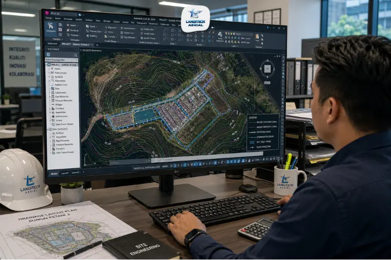
A drone contour map Malaysia is one of the most requested deliverables in Malaysian engineering and construction practice, and also one of the most commonly misspecified. Engineers request “contours” without specifying the interval, source model, or format. As a result, they receive a dataset that doesn’t match their design platform or accuracy requirements. This guide explains how drone contour maps are generated, which intervals suit each Malaysian application, and what formats to request.
Key takeaways
- Photogrammetry software generates drone contour maps Malaysia from a DTM (Digital Terrain Model), not a DSM. On vegetated sites, always confirm your provider uses LiDAR or a filtered bare-earth model.
- Standard contour intervals are 0.5m, 1m, and 2m. The right interval depends on terrain relief and how engineers will use the data.
- DXF is the standard format for AutoCAD and Civil 3D. Always request DXF (or DWG) for engineering design work, and SHP for GIS platforms.
- Drone contour maps achieve accuracy matching traditional survey methods, confirmed within approximately 2.4 cm of traditional survey spot checks at 90% of check points.
What is a drone contour map Malaysia?
A contour line represents a line of equal elevation across the terrain surface. A contour map is a set of these lines at regular vertical intervals that together describe the shape of the terrain in two dimensions. Typical intervals are 0.5, 1, or 2 metres of elevation change.
To generate drone contour maps Malaysia, photogrammetry software first processes drone survey data to produce a DTM. Contour generation algorithms then run on that DTM to extract lines of equal elevation at the specified interval. The output is a vector file of polylines, each representing one elevation level, delivered in DXF, DWG, or SHP format.
The key distinction from the terrain model itself is that contours are a simplified, human-readable representation of terrain. Rather than the full point cloud or raster DTM underneath, they are optimised for engineering drawings, planning submissions, and drainage analysis.
DTM vs DSM: the critical source model requirement
The most important technical requirement for drone contour maps Malaysia is that contours must come from a DTM (Digital Terrain Model), not a DSM (Digital Surface Model). While a DTM shows the bare-earth surface, a DSM shows the top of vegetation and structures.
On vegetated sites, forested development land, oil palm estates, or rubber plantations, drone photogrammetry produces a DSM of the vegetation canopy. It does not capture the bare ground beneath. Contours from this DSM follow the canopy surface elevation, which may sit 8 to 15 metres above actual ground level in mature plantation areas.
When an engineer uses DSM contours for drainage design, earthworks, or road design, they are working from the canopy surface, not the ground. The data becomes useless for those purposes.
On vegetated sites, bare-earth DTM production requires either:
- LiDAR survey. Laser pulses penetrate canopy gaps to reach ground level, producing a true bare-earth point cloud.
- Photogrammetry with filtering. On low-vegetation sites, ground-return classification algorithms filter out low vegetation to produce an approximate bare-earth model.
For a full guide to DTM vs DSM in Malaysian contexts, read our drone DTM Malaysia guide.
Contour intervals: which to specify for Malaysian projects
The contour interval determines how densely the terrain is represented. It directly affects how useful the output is for its intended engineering purpose.
0.5 metre interval
Use for sites with gentle terrain where precision matters: flat development sites, drainage design in low-lying coastal areas, paddy field drainage planning, and fine earthworks grade design.
In Malaysia, 0.5m contours suit:
- Kuala Lumpur and Selangor coastal plain sites (Klang, Shah Alam, Sepang) where total elevation change may be only 2 to 5 metres
- MSMA stormwater drainage design on flat sites where small elevation differences define catchment boundaries
- OSC planning submissions for local authorities requiring detailed topographic plans
1 metre interval
Use for standard construction and development sites with moderate terrain relief. This is the most common specification for Malaysian housing scheme and commercial development surveys.
1m contours suit:
- Typical Klang Valley, Iskandar Malaysia, and Penang development sites with 5 to 30 metres of elevation variation
- Road design topographic surveys where 1m vertical accuracy is sufficient for alignment and grade design
- Industrial park and logistics facility site surveys
2 metre interval
Use for large sites with significant terrain relief: highland areas, sloped plantation terrain, and corridor surveys where broad terrain shape matters more than fine vertical detail.
2m contours suit:
- Cameron Highlands and Titiwangsa range regional terrain mapping
- Oil palm estate terrain overview surveys where broad slope analysis drives replanting layout
- Flood catchment terrain modelling over large river basin areas in Pahang and Kelantan
0.2 metre interval
High-accuracy drone surveys using RTK positioning and GCPs can achieve this interval on open terrain. Use it for precision grading design: car park level design, sports ground grading, and fine earthworks grade verification.
Drone contour map Malaysia: format guide
| Format | Platform | Use |
|---|---|---|
| DXF | AutoCAD, Civil 3D, MicroStation | Standard engineering drawing import |
| DWG | AutoCAD, Civil 3D | Native AutoCAD format |
| SHP (Shapefile) | ArcGIS, QGIS | GIS analysis and planning layers |
| PDF (georeferenced) | Any viewer | Client presentation and tender documents |
| KML | Google Earth | Visual reference overlay |
Always request DXF or DWG for engineering design work. AutoCAD Civil 3D, the standard Malaysian civil engineering platform, imports DXF contour files directly as a base map layer. Engineers then trace roads, drainage, and earthworks design over the contour base.
Also specify GDM2000/RSO as the coordinate reference system. When providers deliver DXF files in WGS84, they won’t overlay correctly with Malaysian local authority GIS layers or JUPEM cadastral data. For a guide to coordinate systems in Malaysian drone surveying, read our RTK drone survey Malaysia guide.
Malaysian applications for drone contour maps
MSMA drainage design
The Manual Saliran Mesra Alam (MSMA) stormwater management framework is mandatory for all Malaysian development projects. It requires accurate catchment boundary definition for drainage design calculations. Catchment boundaries follow topographic contour lines, the ridge lines between drainage basins.
Drone contour maps Malaysia at 0.5m or 1m intervals give drainage engineers the terrain representation they need to define sub-catchments, calculate runoff volumes, and size retention ponds. Because drone DTM contours carry higher point density than manually interpolated contours from sparse total station spot elevations, they are more accurate on sites with irregular micro-topography.
For a full guide to drone surveys for land development including MSMA requirements, read our drone land development Malaysia guide.
OSC planning submission topographic plan
Malaysian local authorities require a topographic plan as part of the development order (DO) application package through the One Stop Centre (OSC) process. This plan shows existing terrain contours, drainage features, vegetation, and structures across the site.
Drone contour maps at 1m intervals, delivered as DXF for engineering drawing overlay or PDF for planning presentation, satisfy the topographic requirement for most local authority OSC submissions. However, confirm the specific format and coordinate system requirement with your local authority before briefing the survey.
Road and highway design
Vertical alignment design for Malaysian roads and highways depends on accurate terrain contours along the proposed alignment. Cross-sections at regular stations (typically every 20 to 50 metres) show existing terrain against the design formation level, the basis for earthworks volume calculations.
Drone contour maps at 1m intervals with DXF delivery give civil engineers the terrain data they need in AutoCAD Civil 3D to generate cross-sections, calculate cut-fill volumes, and design vertical alignment. The full orthomosaic delivered alongside the contours also lets engineers check context, existing structures, trees, and utility corridors, against the alignment design.
Plantation replanting layout
Terrace design for oil palm replanting on sloped terrain uses contour maps to define terrace alignments that follow topographic contours. This minimises erosion and optimises planting density. Drone contour maps at 1m intervals from a bare-earth LiDAR survey give estate planning teams the terrain basis they need for terrace layout design.
Accuracy of drone contour maps Malaysia
RTK photogrammetry produces drone-derived contours that match traditional survey spot elevations to within approximately 2 to 3 cm at 90% or more of independent check points on open terrain. This is equivalent to conventional total station survey accuracy for most Malaysian engineering applications.
For projects requiring tighter accuracy, such as fine grading design or grade verification, adding GCPs (Ground Control Points) improves the result to ±1 to 2 cm. This additional fieldwork adds to the survey cost. However, it brings drone contour accuracy within the tightest Malaysian engineering survey tolerance requirements.
Frequently asked questions
What contour interval should I request for a Malaysian construction site?
For most Malaysian housing scheme and commercial development sites, 1m contour interval is the standard specification. It is sufficient for road design, drainage layout, and earthworks calculation on sites with 5 to 30 metres of elevation variation. On flat coastal sites (Klang, Sepang, Shah Alam areas) where MSMA catchment boundary definition requires fine resolution, specify 0.5m intervals instead. When working on large plantation or highland terrain surveys, 2m intervals are usually sufficient.
Can drone contour maps be used for MSMA drainage design in Malaysia?
Yes, provided the provider generates contours from an accurate DTM at an appropriate interval (0.5m or 1m for most drainage design applications). The DTM must represent the bare-earth ground surface, not the vegetation canopy DSM. On cleared development sites, drone photogrammetry produces a near-DTM. On vegetated sites, however, the survey needs LiDAR to capture bare-earth terrain beneath the canopy for accurate drainage catchment definition.
What is the difference between requesting “contours” and requesting a “DTM”?
A DTM is a raster elevation grid where every pixel carries an elevation value. Engineers use it directly in hydraulic modelling and Civil 3D earthworks analysis. Contours, however, are derived vector lines the software extracts from the DTM at specified elevation intervals. They are used in engineering drawings and planning submissions. Both are useful; which you need depends on your application. For drainage modelling and earthworks design, request both the DTM and the contour DXF.
Conclusion
Drone contour map Malaysia delivers the terrain representation that Malaysian civil engineers, drainage designers, planners, and project managers depend on, generated faster, at higher point density, and at equivalent accuracy to traditional survey methods.
Getting the specification right matters. Choose the correct interval for your application, specify DTM as the source model, and request DXF or DWG in GDM2000/RSO for your AutoCAD workflow. These three decisions determine whether you receive a drone contour map that integrates seamlessly into your project or one that needs costly reprocessing.
LangiTech Aerial produces drone contour maps Malaysia at your specified interval and format, in the correct Malaysian coordinate system, with 24 to 48 hour turnaround from flight to deliverable.
Contact LangiTech Aerial to discuss your contour map requirements and get a survey quote.
For a full guide to drone mapping deliverables, read our drone photogrammetry Malaysia guide.
Need Help Planning a Compliant Drone Project in Malaysia?
Speak with our team about commercial drone operations, compliance requirements, and the right aerial solution for your project.