
3D Mapping & Surveying
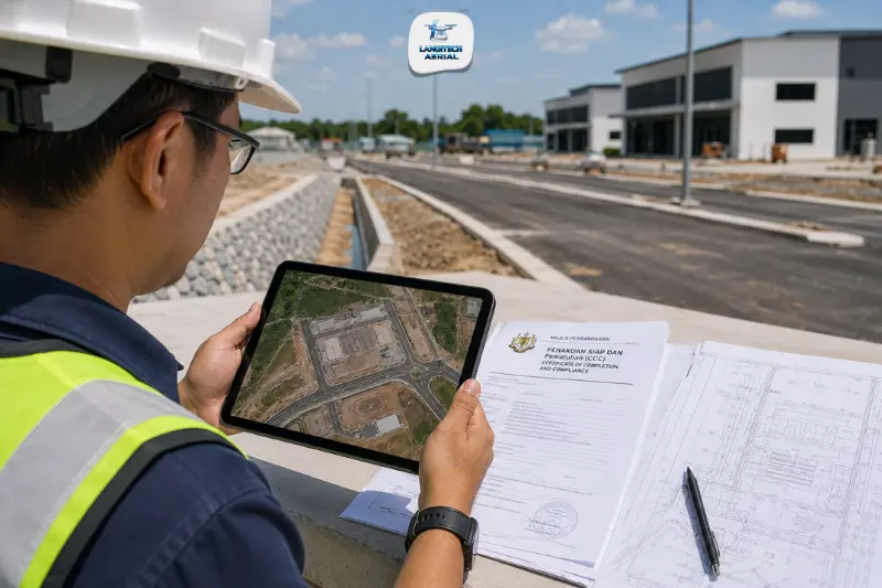
A drone as-built survey Malaysia documents what was actually built, not what was designed. Roads, drainage channels, earthworks formation levels, retention ponds, and infrastructure as constructed on the ground frequently differ from approved engineering drawings in alignment, gradient, and extent. These differences matter because the PSP can only issue the Certificate of Completion and Compliance (CCC) when satisfied that construction complies with approved plans. JKR infrastructure handover, strata title applications, and Malaysia’s 2026 BIM mandate all require accurate as-constructed spatial records too. This guide covers what drone as-built survey Malaysia delivers, which Malaysian construction milestones it supports, and how its scope differs from the building structure as-built surveys that other providers focus on.
Key takeaways
- Drone as-built survey Malaysia documents site infrastructure as constructed: roads, drainage, earthworks, and formation levels, providing the PSP with spatial evidence that construction complies with approved plans for CCC certification.
- As-built drone surveys support four key Malaysian completion milestones: CCC application, JKR infrastructure handover, strata title subdivision, and the 2026 CIDB BIM mandate for projects above RM10 million.
- The most important application is pre-CCC formation level verification, confirming that earthworks and roads have been completed to approved design levels before the PSP certifies completion.
- All drone as-built survey Malaysia operations require a CAAM ATF and JUPEM APK permit before deployment.
What is a drone as-built survey Malaysia?
An as-built survey records the physical state of a construction project at completion, capturing actual positions, levels, and extents of all constructed elements rather than the design intent.
Drone as-built survey Malaysia focuses on the site infrastructure layer: the civil engineering works that underpin the development.
- Road alignments and gradients as constructed
- Drainage channel positions, inverts, and gradients
- Earthworks formation levels across building pads, roads, and open areas
- Retention pond and sedimentation pond positions and extent
- Infrastructure boundary and perimeter as constructed
This is distinct from building structure as-built surveys, which cover floor plans, ceiling heights, and structural element positions. Both serve complete project documentation, but drone aerial surveys address the site infrastructure layer specifically.
Why as-built data differs from approved design
Malaysian construction projects, particularly earthworks-intensive housing schemes, industrial parks, and infrastructure developments, accumulate differences between approved engineering drawings and actual constructed conditions throughout the build.
These differences arise from several sources.
Site conditions. Actual ground conditions encountered during construction, unexpected rock, soft ground, or drainage issues, force field adjustments to road alignments, drainage gradients, and earthworks extents that contractors don’t always formally vary through the approval process before works proceed.
Earthworks tolerance. Even well-controlled earthworks deviate from design formation levels by 20 to 50 mm across large site areas. These deviations fall within engineering tolerance, but they create differences that affect drainage performance and slab bearing capacity if left undocumented.
Infrastructure repositioning. Underground utilities, drainage connections, and access roads frequently shift from their designed positions as construction progresses, to avoid unexpected site features or to coordinate with adjacent works.
A drone as-built survey Malaysia captures the actual positions, levels, and extents of all these elements at project completion, giving the PSP, JKR, and LA the spatial evidence they need for compliance verification.
Four Malaysian milestones supported by drone as-built surveys
1. CCC application: pre-certification survey
The Principal Submitting Person (PSP), a registered architect (PAM) or engineer (BEM), issues the Certificate of Completion and Compliance (CCC) when satisfied that construction complies with all approved plans and technical conditions imposed by the Local Authority (LA).
Before the PSP can certify site infrastructure compliance, they need evidence that roads, drains, earthworks, and external works have reached approved positions and levels. Drone as-built survey Malaysia provides that evidence:
- Formation level survey. Confirming that earthworks across building pads and road formation are within ±50 mm of approved design levels.
- Drainage as-built. Documenting drainage channel positions and verifying gradients are correctly formed for positive flow.
- Road as-built. Confirming road alignment, formation level, and kerb positions match the approved road plan.
- External infrastructure. Retention ponds, boundary walls, and perimeter fencing positions versus approved layout.
The drone as-built survey orthomosaic and DTM overlay directly onto the approved engineering drawings in AutoCAD Civil 3D, enabling the PSP to identify any out-of-compliance areas requiring correction before CCC certification proceeds.
This pre-CCC survey is the most commercially important drone as-built survey Malaysia application, because delays in CCC affect developer HDA final drawdown, homebuyer key collection, and property handover timelines.
2. JKR infrastructure handover
After CCC, developers formally hand over Malaysian road and drainage infrastructure to JKR (federal roads and drains) or the local authority (state roads and municipal drains). This handover process requires as-built documentation of all infrastructure elements transferring to public ownership.
Drone as-built survey Malaysia provides the JKR submission package:
- Georeferenced orthomosaic of all roads and drains as constructed
- Road formation level survey confirming grades within specification
- Drainage as-built with channel positions, gradients, and culvert locations
- Retention pond volume calculation confirming design storage capacity
JKR’s infrastructure acceptance team uses this data to verify that the infrastructure meets approved standards, and that the public will subsequently maintain what was actually built rather than what was designed.
3. Strata title subdivision
For stratified developments, condominiums, serviced apartments, and commercial strata, the strata title application to the Land Office requires accurate survey documentation of the development site and building footprints. A Licensed Land Surveyor (LLS) conducts the statutory strata survey. However, drone as-built data supports this process by providing the site orthomosaic and terrain data that the LLS uses as survey context for their cadastral work.
Drone orthomosaics of the completed strata development also give management corporations (MC) and joint management bodies (JMB) accurate common property base maps, documenting car parks, landscape areas, access roads, and boundary walls as constructed for ongoing facility management.
4. BIM mandate compliance (CIDB 2026)
CIDB‘s 2026 BIM mandate requires Building Information Modelling for public and private construction projects above specified value thresholds. As-built BIM models capture the building as constructed for facilities management, renovation planning, and lifecycle management. Since they require accurate spatial data of both the building structure and the site infrastructure, a drone survey feeds the site layer directly.
Drone as-built survey Malaysia provides the site infrastructure reality capture layer that feeds the as-built BIM model:
- Site orthomosaic as the BIM site plan reference
- DTM surface for terrain and drainage modelling within the BIM model
- Road and infrastructure positions for site services coordination
For projects above RM10 million that fall under the CIDB BIM mandate, a drone as-built survey is now a practical requirement of complete project documentation, not an optional addition.
Drone as-built survey Malaysia: key deliverables
| Deliverable | Format | Application |
|---|---|---|
| As-built orthomosaic | GeoTIFF | CCC, JKR handover, LA submission |
| Formation level survey | DTM + report | CCC earthworks verification |
| Road as-built plan | DXF overlay | JKR handover, LA acceptance |
| Drainage as-built | DXF + gradient report | JKR handover, MSMA compliance |
| Retention pond volume | Excel, PDF | JKR/LA compliance verification |
| Point cloud | LAZ | BIM mandate, as-built model |
| CCC support report | PSP certification documentation |
How drone as-built differs from construction progress surveys
Malaysian construction projects often run drone progress surveys throughout the construction phase: monthly earthworks monitoring, progress reporting, and BOQ reconciliation. The drone as-built survey Malaysia is a distinct, final-stage deliverable.
| Factor | Progress Survey | As-built Survey |
|---|---|---|
| Timing | Monthly during construction | Once at completion |
| Purpose | Track progress vs programme | Document what was built |
| Audience | Project manager, QS | PSP, JKR, LA, Land Office |
| Deliverable | Progress comparison maps | Compliance documentation |
| Accuracy | ±5 cm sufficient | ±2 to 5 cm required |
| Output | Progress percentage maps | Engineering drawing overlays |
For a guide to construction progress surveys, read our drone progress monitoring Malaysia guide. For earthworks BOQ surveys, read our drone cut fill Malaysia guide.
Accuracy requirements for drone as-built survey Malaysia
CCC and JKR handover documentation require that as-built surveys meet the engineering accuracy tolerances specified in the project’s technical requirements. For most Malaysian housing and commercial development projects:
- Horizontal accuracy: ±2 to 5 cm, sufficient for road alignment and infrastructure position documentation.
- Vertical accuracy (formation levels): ±2 to 5 cm, sufficient for earthworks compliance verification against ±50 mm tolerance.
RTK-enabled drone as-built surveys achieve these specifications without additional Ground Control Points on open construction sites. When the PSP requires independently verified accuracy, or when the LA may audit the as-built survey, adding 3 to 5 independently surveyed check points provides third-party verifiable accuracy confirmation.
For a full guide to drone survey accuracy in Malaysian projects, read our RTK drone survey Malaysia guide.
CAAM and JUPEM compliance for drone as-built survey Malaysia
All drone as-built survey Malaysia operations require:
CAAM ATF. Submit the Authorisation to Fly application to CAAM at least 14 working days before the survey. At project completion, sites are typically no longer active construction. However, adjacent occupied residential areas and public roads require ATF parameters that address flight near occupied structures.
JUPEM APK permit. Drone as-built surveys capture georeferenced aerial data, triggering the JUPEM aerial data acquisition security clearance requirement. Apply through the eBiz JUPEM portal before the CAAM ATF application.
LangiTech Aerial manages both permit applications as part of every drone as-built survey Malaysia engagement, ensuring project managers and PSPs receive fully compliant survey data.
For a full permit guide, read our drone permit Malaysia requirements guide.
Frequently asked questions
When should the drone as-built survey Malaysia be conducted relative to CCC application?
Conduct the as-built survey when all external infrastructure works, roads, drains, earthworks, and boundary walls, reach substantial completion, and always before the PSP submits the CCC. This timing allows the PSP to review the as-built data, identify any areas of non-compliance, and have the contractor rectify them before certification. Conducting the survey after CCC submission creates a compliance risk if the as-built data reveals deviations that require retrospective variation approval.
Does drone as-built survey Malaysia satisfy JKR’s infrastructure handover documentation requirements?
Drone as-built survey data, georeferenced orthomosaic, road and drain DXF overlays, and formation level survey, satisfies JKR’s standard infrastructure handover documentation requirements for housing and commercial development projects. For major road or drainage infrastructure handover involving Licensed Land Surveyor certified deliverables, discuss the specific LA and JKR requirements with your PSP before briefing the survey.
How does drone as-built survey differ from a licensed survey for strata title?
A Licensed Land Surveyor (LLS) conducts the statutory strata survey, measuring and certifying the building parcel positions and floor areas for strata title application. A drone as-built survey Malaysia, however, provides the site infrastructure spatial data that supports this process: the site orthomosaic, road and boundary positions, and common area extents that give the LLS and the MC spatial context for their statutory work. Complete strata development documentation needs both.
Conclusion
Drone as-built survey Malaysia delivers the spatial evidence that Malaysian construction projects need to cross the most consequential milestones of the development lifecycle: CCC certification by the PSP, JKR infrastructure handover, strata title subdivision, and BIM mandate compliance.
The most time-critical application is pre-CCC formation level verification, catching earthworks and infrastructure deviations before the PSP certifies rather than after. A single as-built survey that identifies drainage gradient reversals or formation level shortfalls before CCC submission pays for itself many times over in avoided delays and LA re-submission costs.
LangiTech Aerial provides CAAM and JUPEM-compliant drone as-built survey Malaysia services for housing schemes, commercial developments, industrial parks, and infrastructure projects across Peninsula Malaysia.
Contact LangiTech Aerial to discuss your project’s as-built survey requirements and get a quote.
For a broader guide to drone construction surveys, read our drone land development Malaysia guide.
Need Help Planning a Compliant Drone Project in Malaysia?
Speak with our team about commercial drone operations, compliance requirements, and the right aerial solution for your project.