
3D Mapping & Surveying
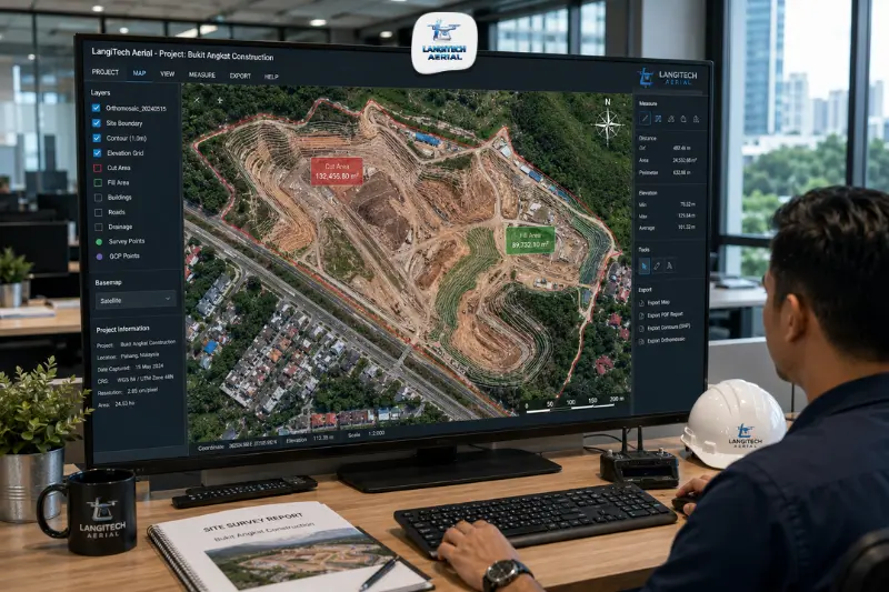
A drone orthomosaic Malaysia is not aerial photography, and understanding that distinction changes how you specify, receive, and use drone survey data. Standard aerial photography distorts edges and corners because the camera captures perspective from a single viewpoint, like any photograph. An orthomosaic, by contrast, applies geometric correction across every pixel: photogrammetry software removes perspective distortion, embeds spatial coordinates, and stitches hundreds of overlapping images into a single map where every point sits in its accurate position relative to every other. As a result, you can measure distances, calculate areas, trace boundaries, and load the image as a base layer directly into AutoCAD, ArcGIS, or QGIS. This guide explains what drone orthomosaic Malaysia delivers, what resolution specifications mean for your project, and when an orthomosaic alone is sufficient versus when you also need a DTM or point cloud.
Key takeaways
- A drone orthomosaic Malaysia is a geometrically corrected, georeferenced aerial image, not a photograph. Every pixel carries accurate spatial coordinates, making distances, areas, and boundary tracing measurable directly from the image.
- Ground Sampling Distance (GSD), the size of each pixel on the ground, is the key resolution specification. For Malaysian construction and engineering use, 2 to 5 cm GSD is the standard working specification.
- An orthomosaic alone is sufficient for visual documentation, progress monitoring, condition assessment, and base mapping. You need a DTM additionally when drainage design, earthworks volumes, or terrain-dependent engineering calculations are required.
- Deliver drone orthomosaic Malaysia data in GDM2000/RSO coordinate system for compatibility with JUPEM national data and Malaysian GIS platforms.
Orthomosaic vs aerial photography: the key distinction
This is the question Malaysian project managers and engineers most frequently need answered before requesting drone survey data.
Standard aerial photography
A standard aerial photograph captures the ground from a single camera position. Objects at the edges and corners of the image appear displaced from their true ground position, an effect called radial distortion and perspective displacement. When you measure a distance on a standard photograph, the result is only accurate at the centre of the image where distortion is minimal.
Standard aerial photographs work well for visual reference — they show what a site looks like. However, you can’t load them into AutoCAD or ArcGIS for measurement or mapping without significant correction work first.
Drone orthomosaic Malaysia
To produce an orthomosaic, photogrammetry software processes hundreds of overlapping drone images. The software identifies the same physical points across multiple overlapping images, calculates precise 3D positions for each point, then resamples each image to remove perspective distortion, projecting every pixel to its true nadir (directly below) position. It then stitches the corrected images into a single seamless map.
The result is a planimetric image where every pixel represents an accurate ground position. You can measure the distance between any two points directly, calculate areas by tracing boundaries, and load the orthomosaic as a georeferenced base layer in any GIS or CAD platform. Distances measured from a drone orthomosaic Malaysia at 2 to 5 cm GSD are accurate to within that pixel size.
Understanding Ground Sampling Distance (GSD)
GSD is the size of each pixel on the ground: the fundamental resolution specification for drone orthomosaic Malaysia work.
A GSD of 2 cm means each pixel represents a 2 cm × 2 cm area of ground. An object smaller than 2 cm merges with adjacent pixels and the image can’t distinguish it. An object larger than 2 cm appears as multiple pixels, with enough resolution to identify and measure it.
GSD specifications for Malaysian applications
| Application | Recommended GSD | Flight altitude |
|---|---|---|
| Construction progress monitoring | 3–5 cm | 80–120 m |
| Earthworks BOQ and grade control | 2–4 cm | 60–100 m |
| Road and infrastructure surveys | 2–3 cm | 50–80 m |
| Oil palm estate mapping | 3–5 cm | 80–120 m |
| OSC planning submission topographic | 3–5 cm | 80–120 m |
| Detailed facade or structure documentation | 0.5–2 cm | 10–30 m |
| Stockpile and quarry surveys | 2–4 cm | 60–100 m |
Finer GSD requires lower flight altitude, which produces more images and longer processing time. Higher GSD covers area faster at lower image density. For most Malaysian construction and development applications, 3 to 5 cm GSD delivers the right balance of resolution and operational efficiency.
When orthomosaic alone is sufficient
Many Malaysian project teams request a full drone survey package, orthomosaic, DTM, contours, and point cloud, when their project only needs an orthomosaic. Knowing when each is sufficient saves survey cost.
Orthomosaic alone is sufficient for:
- Construction progress documentation. Monthly orthomosaics show site progress at a specific date. Visual comparison between months communicates advancement clearly without elevation data.
- Oil palm estate block mapping. Tracing block boundaries, road networks, and plantation extents from the orthomosaic is the primary use case. Elevation data isn’t needed for estate GIS record updating.
- Road and pavement condition mapping. An orthomosaic identifies crack patterns, pothole locations, faded road markings, and drainage condition visually. No DTM required.
- Post-flood damage documentation. An orthomosaic showing the extent of flooding, damaged roads, and affected structures is the primary evidence deliverable. Elevation data is secondary.
- OSC planning base mapping. Local authorities reviewing development orders need to see what’s on the site. The orthomosaic is the primary deliverable.
You additionally need a DTM when:
- Earthworks cut-fill calculations are required
- MSMA drainage design depends on terrain flow paths
- Road design requires cross-section elevation data
- Replanting terrace layout needs terrain-based design
- Flood inundation modelling needs bare-earth terrain
For a guide to when DTM is required and the DSM vs DTM distinction, read our drone DTM Malaysia guide.
Drone orthomosaic Malaysia: output formats and platform compatibility
The orthomosaic format you request should match the platform your team uses:
| Format | Platform | Use |
|---|---|---|
| GeoTIFF | ArcGIS, QGIS, AutoCAD | Standard raster — works in all platforms |
| ECW | ArcGIS, ERDAS | Compressed large-area orthomosaics |
| MrSID | ArcGIS | Compressed raster for web GIS |
| SLPK (Scene Layer Package) | ArcGIS Pro / Online | 3D tile streaming for web viewers |
| JPG/PNG (non-georeferenced) | Any viewer | Visual reference only — not measurable |
Always request GeoTIFF as the primary delivery format. ArcGIS, QGIS, AutoCAD (Image Manager), and Civil 3D all support it natively, and it retains all spatial coordinate data.
Always specify GDM2000/RSO as the coordinate reference system too. This ensures your orthomosaic overlays correctly with JUPEM national base data, local authority GIS layers, and other Malaysian spatial datasets. When clients don’t specify their coordinate system requirement upfront, an orthomosaic delivered in WGS84 shows a systematic offset against Malaysian national GIS data — a common and avoidable problem.
Malaysian industry applications for drone orthomosaic
Construction sites: monthly progress records
The most common drone orthomosaic Malaysia application is monthly construction progress documentation. A dated, georeferenced orthomosaic of an active site shows the state of earthworks, structural progress, access roads, and drainage at the end of each reporting period.
Project managers load the orthomosaic into AutoCAD as a background reference, overlaying construction drawings against the actual site condition to identify what’s ahead of programme, what’s behind, and where the site differs from the approved design. For a full guide to construction progress surveys, read our drone progress monitoring Malaysia guide.
Oil palm estate management
Estate managers use drone orthomosaics as the base layer for their estate GIS systems. From the orthomosaic, they trace block boundaries and compare them to title plan boundaries, map road networks, and identify infrastructure features such as culverts, bridges, and collection ramps, recording each as an estate asset layer.
When estates use a multispectral sensor rather than a standard RGB camera, NDVI and multispectral orthomosaics extend this to crop health mapping, flagging low-vigour zones for agronomic investigation. For a full guide, read our drone oil palm mapping Malaysia guide.
JPS and local authority base mapping
Malaysian government agencies, JPS for drainage management and local authorities for development control, use drone orthomosaics as current, high-resolution base maps for their GIS systems. A drone orthomosaic at 3 to 5 cm GSD is far more detailed than commercially available satellite imagery (typically 30 to 50 cm GSD) and current to within weeks rather than satellite revisit cycles.
For GIS integration requirements including coordinate systems and file formats for Malaysian government agencies, read our drone GIS Malaysia guide.
Frequently asked questions
What is the difference between a drone orthomosaic and an aerial photograph?
An aerial photograph captures perspective from a single viewpoint, so objects at image edges shift from their true ground position and distance measurements are only accurate at the centre. A drone orthomosaic Malaysia, however, applies geometric correction across every pixel, with perspective displacement removed and spatial coordinates embedded at every point. You can then measure accurate distances, calculate areas, and load the orthomosaic as a georeferenced base layer in AutoCAD or ArcGIS — something an aerial photograph can’t do without significant additional processing.
What GSD should I request for a Malaysian construction site orthomosaic?
For most Malaysian construction progress monitoring and earthworks management, 3 to 5 cm GSD is the standard working specification. It’s sufficient to identify construction elements, measure progress zones, and serve as a useful AutoCAD or GIS reference layer. For more precise grade control verification or road condition mapping, 2 to 3 cm GSD improves resolution for detailed feature identification. Before specifying GSD, confirm your specific use case with your drone provider: finer resolution means lower flight altitude and longer processing time, which affects cost and turnaround.
What coordinate system should a drone orthomosaic Malaysia use?
Specify GDM2000 (Geodetic Datum Malaysia 2000) projected in RSO (Rectified Skewed Orthomorphic), Malaysia’s national coordinate reference system. GeoTIFF orthomosaics in GDM2000/RSO overlay directly with JUPEM national data, local authority GIS layers, and other Malaysian spatial datasets. When you deliver in WGS84 alone, a systematic offset appears against Malaysian national GIS data. Always include your coordinate system requirement in your survey brief.
Conclusion
A drone orthomosaic Malaysia is one of the most useful and widely applied drone survey deliverables, because it turns aerial imagery from a visual reference into a measurable, geospatially accurate base map that integrates directly into the AutoCAD, ArcGIS, and QGIS workflows that Malaysian engineers, planners, and estate managers use daily.
Understanding GSD, specifying GDM2000 coordinates, and knowing when an orthomosaic alone is sufficient versus when a DTM is also needed: these three points let you brief drone surveys accurately and receive deliverables your team can actually use.
LangiTech Aerial produces drone orthomosaic Malaysia outputs configured for your specific platform, resolution, and coordinate system requirements, delivered within 24 to 48 hours of each flight.
Contact LangiTech Aerial to discuss your project’s orthomosaic requirements and get a quote.
For the full drone mapping technology guide, read our drone photogrammetry Malaysia guide.
Need Help Planning a Compliant Drone Project in Malaysia?
Speak with our team about commercial drone operations, compliance requirements, and the right aerial solution for your project.